
Walk a Baldwin County Street
A Baldwin County address-records search can establish who owns a parcel and which public records connect people to an address. It cannot begin with a guess about who lives there. Start with the physical site. The Revenue Commissioner separates the situs address, meaning the place where the parcel sits, from the mailing address used for tax notices. The same address can then lead to the mapped parcel, current deed reference, permit history, and selected voter data. Each record proves a different point, so dates and names must be kept with their sources.
- Verify the current address through USPS or the proper 911 addressing office. Keep the unit, road prefix, and directional wording exactly as shown.
- Search the Revenue Commissioner's property system by address. Save the parcel number, legal description, owner, situs, and owner mailing address.
- Open the county map viewer. Select the parcel polygon, then move along the same street segment and inspect each linked appraisal card.
- Use the deed reference to open the current instrument. Search its grantor as an earlier grantee when an ownership chain is needed.
- Check both permit channels, a lawful geographic voter extract, and historical tax, directory, or newspaper records for dated links to occupants.
The practical flow is address → parcel → owner → deed → dated household evidence. A name that appears in only one layer is a lead, not a final match. Baldwin County streets often cross postal, municipal, and unincorporated lines, so confirm jurisdiction before asking for permits or address records.
Baldwin County Street Directory Fields
The free Baldwin County Property Search offers three main routes. An address search is best for one known site. An owner-name search can reveal more parcels held by the same person or entity, while a parcel number is the cleanest key after the map or tax bill supplies it. Reduce the street text if punctuation, a directional prefix, or a road abbreviation causes a miss.
| Search control | Input | Required | Best street use |
|---|---|---|---|
| Owner Name | Name text | No | Test surname variants and business ownership |
| Address | Situs text | No | Start with number and street, then reduce |
| Parcel Number | County identifier | No | Return to the exact mapped account |
| Property/Account | Result link | Not applicable | Open appraisal and tax details |
| Map Viewer Search | Spatial link | No | Recover sites whose text address fails |
The parcel card may show ownership, mailing and situs addresses, subdivision or lot and block, land and building values, deed references, and exemptions. Fields differ by parcel. A homestead clue may support owner occupancy for a given period, but it still does not list the full household.
Note: A parcel card can lag a recent deed, so compare its assessment cycle with the recording date before drawing a timeline.
Map Baldwin County Streets
Text searches break on new roads, abbreviations, and parcels without a standard situs. The Baldwin County Revenue map gateway supplies the spatial route. Search or zoom to a location, confirm the matched point, and select the parcel rather than relying on a pin alone. The active layer list determines what the map can show. Parcel boundaries and jurisdiction context may be useful, but the viewer is informational and is not a survey.
The official gateway shows where the property and map searches begin.
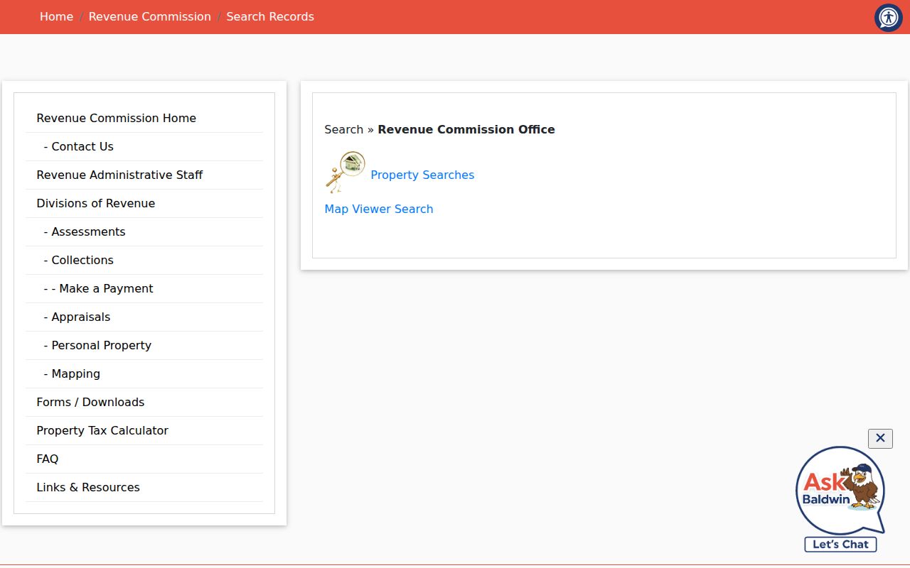
That gateway is the safest entry point when a saved viewer link changes or an address spelling returns no parcel.
For a whole street, pan one segment at a time and click each parcel polygon. Record the parcel number and situs before moving on. Odd and even numbering, cul-de-sacs, condominium common land, and corner parcels can make number order a poor test of physical proximity.
Baldwin County Records by Street
No single Baldwin County by-street source holds every resident. The useful result comes from linking address-keyed sources while preserving their limits. The parcel number joins appraisal and map records. A deed reference joins that parcel to recorded parties, while a legal description, the land's formal lot or boundary wording, stays useful if a road name changes.
| Address source | Record keeper | What it contributes | How to reach it |
|---|---|---|---|
| Appraisal and tax parcel | Revenue Commissioner | Owner, situs, mailing address, parcel and values | Free property search |
| Parcel map | Revenue Commission GIS | Street position, parcel shape and linked account | Free map viewer |
| Deeds, mortgages and plats | Probate Recording Division | Recorded parties, instrument, dates and land description | Online from 1899; counter or mail |
| Voter extract | Secretary of State and registrars | Selected registrants and residence-address fields | Paid geographic request |
| Building permits | County or municipal building office | Site, project, dates and named project parties | Open Baldwin or city office |
| Historic tax, plat and newspaper files | County Archives | Earlier taxpayers, lots, address clues and social notices | Research room or request |
Ownership and occupancy are not the same. Tax mail can go elsewhere, a permit may name a contractor, and a voter record describes one registrant at one point in the election system. A sound by-address result labels each relationship instead of merging them into a household claim.
Baldwin County Street Address Types
A frequent Baldwin County street-search error is treating the tax mailing address as the property address. Situs identifies the parcel's physical location. Mailing address tells where the owner receives notices. A matching pair may support owner occupancy, and a homestead marker can add context. Neither proves that no one else lives there. A different mailing address may point to an absentee owner, a business address, or another delivery choice, but the record alone does not explain why.
- Parcel
- A mapped unit of land tied to a county account and legal description.
- Situs address
- The street location assigned to the land or building, distinct from the tax-mail destination.
- Plat
- A recorded map that lays out lots, blocks, roads, and dedications in a subdivision.
- Criss-cross directory
- A directory arranged by address or telephone number rather than only by a person's name.
The Alabama Department of Revenue also lists the official county appraisal and assessment route. That state directory is a useful fallback when a local bookmark fails.
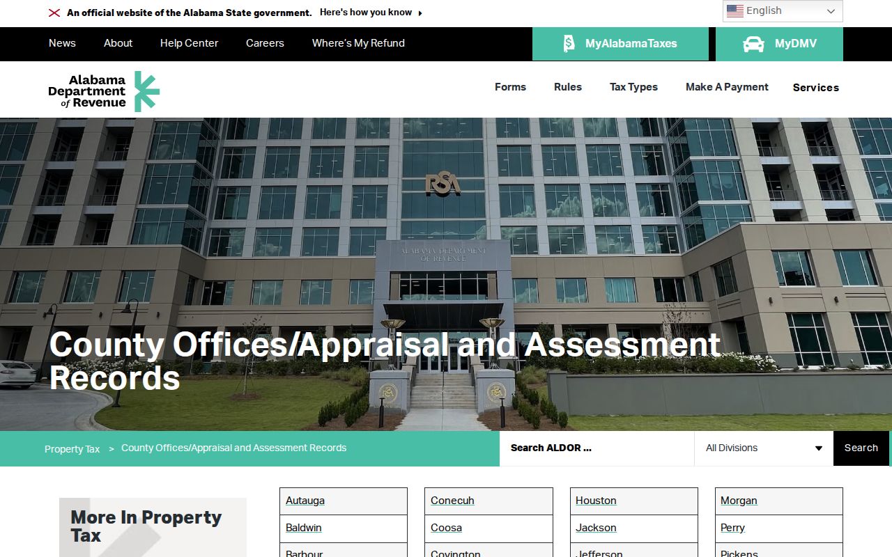
The state listing confirms the custodian path, while the county record remains the source for the parcel details.
Deeds Along Baldwin County Streets
The Baldwin County Probate Recording Division does not rely on street addresses as its main index. Recorded instruments are searched by grantor, grantee, reception or instrument number, book and page, and recording date. A grantor transfers an interest; a grantee receives it. Start with the current parcel's deed citation, open that instrument, and copy both party names plus the exact legal description.
To move back, search the seller from the current deed as a grantee in the earlier purchase. Confirm the same land description before accepting the match. The online deed and mortgage run begins with Book 1 in 1899, and the county says documents can be viewed and printed online. Public viewing stations, mailed copy requests, and counters in Bay Minette, Fairhope, Foley, and Robertsdale provide alternate access. A mailed request should state the instrument number or book and page plus recording date.
Note: The 1899 online threshold marks the index and image boundary, not the start of Baldwin County land ownership.
Baldwin County Street Search Growth
Baldwin County grew from 231,767 residents in 2020 to an estimated 267,761 in 2025. That scale and pace create new subdivisions, repeated street names, fresh 911 assignments, and postal-city mismatches. Coastal streets also include second homes and investment parcels, while rural north and east Baldwin often require legal-description work. A by-address search should therefore keep the parcel ID, municipality, and date beside every address.
No official source identified one countywide street-renumbering event. Do not force an old house number into a modern map. Use the plat, legal description, historic tax record, and any map title sheet as bridges. In unincorporated Baldwin County, 911 GIS & Addressing assigns and verifies addresses. Inside city limits, the relevant municipal planning or building office controls that work.
Baldwin County Street Permit Records
Open Baldwin separates county building reports into permits issued before November 1, 2020 and permit or inspection records after that date. Search both routes when work may span the cutover. A permit can connect an applicant, contractor, parcel, work type, issue date, and status to a site. It dates change at the address, but it does not prove that a named party lived there.
Custody follows jurisdiction. County records cover the county system; a property inside a municipality may require that city's building or code office. Annexation can also shift the keeper for later work while older files remain elsewhere. Confirm the parcel's jurisdiction in GIS, then give the correct office the street address, parcel number, record type, and a bounded date range.
Note: A postal city is a delivery label, so it cannot by itself identify the office that holds a Baldwin permit.
Baldwin Voters by Street
Alabama My Voting Information verifies one person's registration and polling details after first name, last name, date of birth, and county are supplied. It is not a public street browser. For a street-level project, Alabama law provides a separate paid voter-list request under Ala. Code §17-4-38. The form permits geographic scopes such as county, city, and district, plus selected fields that include residence address and mailing address when available.
The file can show status and election participation, but never ballot choices, and Alabama does not register voters by party. Protected records are omitted. Electronic data is priced at one cent per voter, while printed output is one dollar per page; the Elections Division quotes the order before payment. A properly obtained extract can be sorted by residence address. It still covers registered voters only, may reflect recent-move lag, and must not be read as a full Baldwin County street directory.
Older Baldwin Street Directory Clues
When the modern trail runs out, the Baldwin County Department of Archives and History holds deeds, liens, and mortgages from 1804 through 1954, land records from 1890 through 1950, tax books from 1890 through 1979, plats from 1830 through 1979, and lot books from 1919 through 1979. These series preserve the parcel and year even when the street label has changed.
Historical newspapers run from 1890 through 2012 and can add an obituary, social notice, sale, or business tie. The exact Baldwin reverse-directory shelf run was not verified, so no annual sequence should be assumed. The Baldwin County city directory collections are best used as selected snapshots, then checked against deeds, tax books, census records, and newspapers.
Note: A directory year reflects its publisher's snapshot, so confirm the entry against a deed, tax book, census, or dated newspaper.
Baldwin Street Directory Limits
A by-street search made from public records cannot reliably name every person at an address. Deeds and parcel cards center on owners. They often miss non-owner occupants, family members, guests, and recent movers. Permits name people tied to construction. Voter data covers registrants and can lag a move. Utility customer records are not public neighborhood lists, and motor-vehicle address data is restricted by the federal Driver's Privacy Protection Act.
Use two independent, dated sources before treating a person and address as a match. Stop when a protected address appears or when same-name people cannot be separated. Corrections belong with the office that made the record: Revenue for appraisal data, the Board of Registrars for voter data, Probate Recording for an indexed instrument, or the correct building office for a permit.
Lawful use. Baldwin County address records support genealogy, civic research, property questions, and personal safety. Alabama law does not permit stalking, harassment, intimidation, or efforts to defeat an address-protection program.